Home » Research & development » GeoKonstruct


Project Title: “Intelligent Building Information Modeling and Visualization Solutions – GeoKonstruct“
The goal of the GeoKonstruct project was to create a new indoor and small-scale outdoor mapping service, which includes the production of 3D models and the development of a mixed reality environment for the visualization of building information, fully adopting the use of Building Information Models ( Building Information Model – BIM).
In addition, the GeoKonstruct service can be used in the quality control of constructions and renovations, as well as in the maintenance of building infrastructure. It includes the collection of data for the geometric mapping of building information, the production of BIM models and 3D photogrammetric products, the use of a Web application to view, manage, and share the data, as well as the visualization of BIM models through an augmented reality (AR) application.
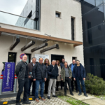
The project was implemented by the partnership GEOANALYSIS SA and NATIONAL CENTER FOR RESEARCH AND TECHNOLOGICAL DEVELOPMENT – INSTITUTE OF INFORMATION AND COMMUNICATION TECHNOLOGIES (EKETA – IPTIL), within the framework of the action Innovation Investment Plans of the Region of Central Macedonia.