Home » Activities » Forestry

Possibilities | Experience
Forests apart from being a source of goods for people and a valuable animal shelter, they also actively contribute to the ecological balance of the planet. Therefore, protection, management and upgrade of forest ecosystems are state’s priority and subject of numerous studies.
GeoAnalysi S.A., using its experience and technology, undertakes forest surveys which deal with all necessary works related to forest ecosystems.
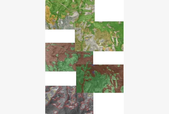
Aiming at forest management zoning and mapping studies are conducted through the preparation of Forest Maps for the Hellenic Cadastre. By means of photo-interpretation and remote sensing (both excellent tools for the identification and characterization of forest areas) and the development of integrated GIS systems, GeoAnalysi S.A. fully takes up studies of digital mapping and management.
In part of the upgrade of the forest ecosystems, the company undertakes the preparation of technical studies for forest roads construction and recreation projects, such as constructing forest paths, erosion control works, hydronomical projects and Environmental Impact assessments.
Finally, in the context of forest protection many studies are implemented such as those for reforestation, fire protection, recovery and regeneration of degraded terrestrial ecosystems and evaluation of fire-affected areas using remote sensing techniques.