Home » Activities » Photogrammetry » Experience
Possibilities | Experience
GeoAnalysi S.A. has a longtime experience in this field as the company has already done a lot of of aerial and terrestrial photogrammetric projects.
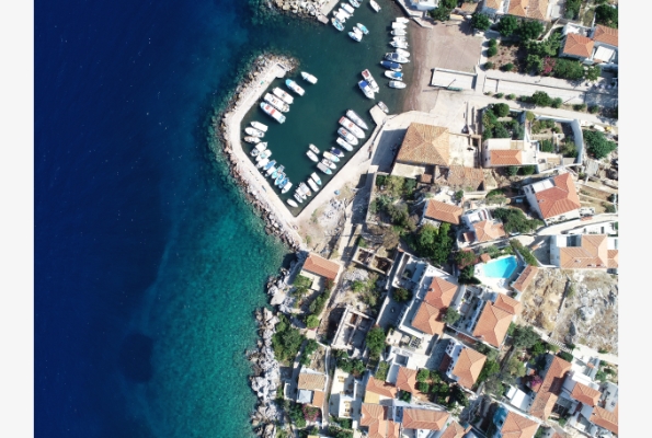
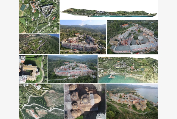
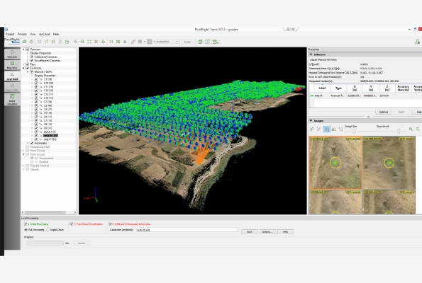
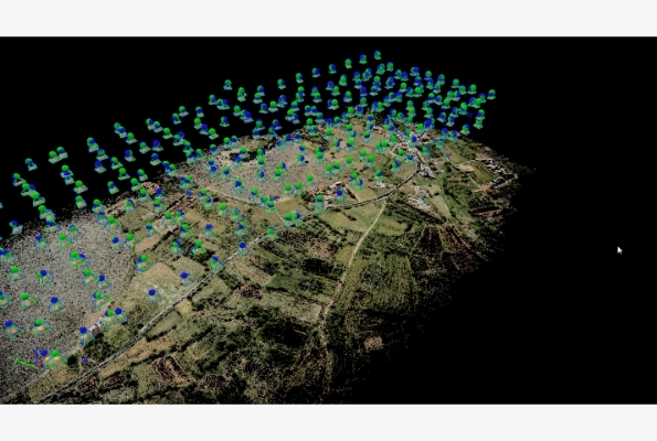
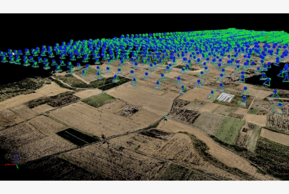
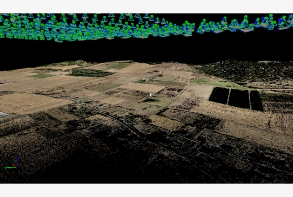
Moreover, it has extensive experience in aerial photography with UAV and in the production of large scale orthophotos for archaeological sites. Considering the field of terrestrial photogrammetry, it has undertaken numerous projects for the production of orthophotos and the architectural documentation of important monuments.
As a result of its experience, GeoAnalysis has developed important research activity which concerns terrestrial photogrammetric applications, Computer Vision techniques and industrial design. Indicatively, some of the photogrammetric projects that the company has completed in the past fifteen years are:
Aerial photogrammetry:
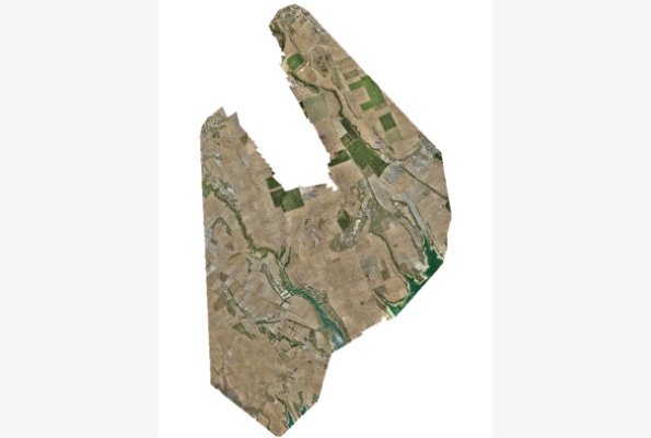
Greek National Cadastre – Production of digital orthophotomaps for the regions:
- Local authority Polycastro and Peukodasos, Prefecture of Kilkis.
- Local authority Avato and Erasmio, Prefecture of Xanthi.
- Local authority Veria, Verginna, Tipotamos, Palatitsio and Ag. Barbara,
- Prefecture of Imathia.
- Magana, Prefecture of Xanthi.
- Islands of Patmos, Elounta, Halkidaion, Salamina.
And the Regional Units of:
Kozani, Kastoria, Chalkidiki, Pellam, South Aegean (Cyclades), Xanthi, Thessalonikia and Drama.
Greek National Statistical Organisation: Development of digital photogrammetric backgrounds in 607 settlements of Greece (over 1000 residents) aiming at the creation of a GIS system.
Min. of Agriculture: Production of satellite orthophotomaps for control of area based arable and forage subsidies using Remote Sensing (1997, 1998, 2000, 2003,2010).
National Electrical Company:
- Aerial photography and production of digital general drawing of the Lignitic Centre region in Megalopolis.
- Aerial photography and production of orthophotographs and DTM in the area of tin deposits of Florina.
- Aerial photography and photogrammetric production for the surveillance of tin deposits in the south area of Ptolemaida Lignite Centre.
- GIS HEDNO network in areas of Eastern Attica and Western Thessaloniki
Production of orthophotomaps (1:50) and diagrams for part of the archaeological site in Delos using UAV.
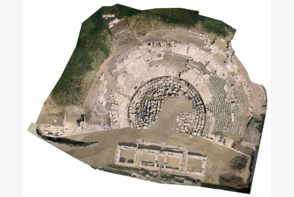
Photogrammetric surveying and production of orthophotomap for the A’ Ancient Theatre of Larissa using UAV.
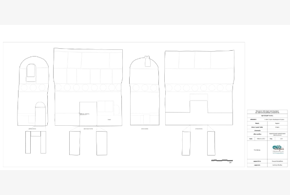
Close-range photogrammetric mapping of facades and sections of the stage in the A’ Ancient Theatre of Larissa.
Production of orthophotomaps for a saving excavation in Derveni (part of Egnatia Road) using UAV.
Photogrammetric surveying and production of coloured orthophotomap with the method of remote controlled aerial photography of the archaeological site in the area east of the Holy Lake on Delos island.
Mapping, documentation and projection of Archaeological Park of Dion, Pieria with digital means (including extended use of RC helicopter aerial photography).
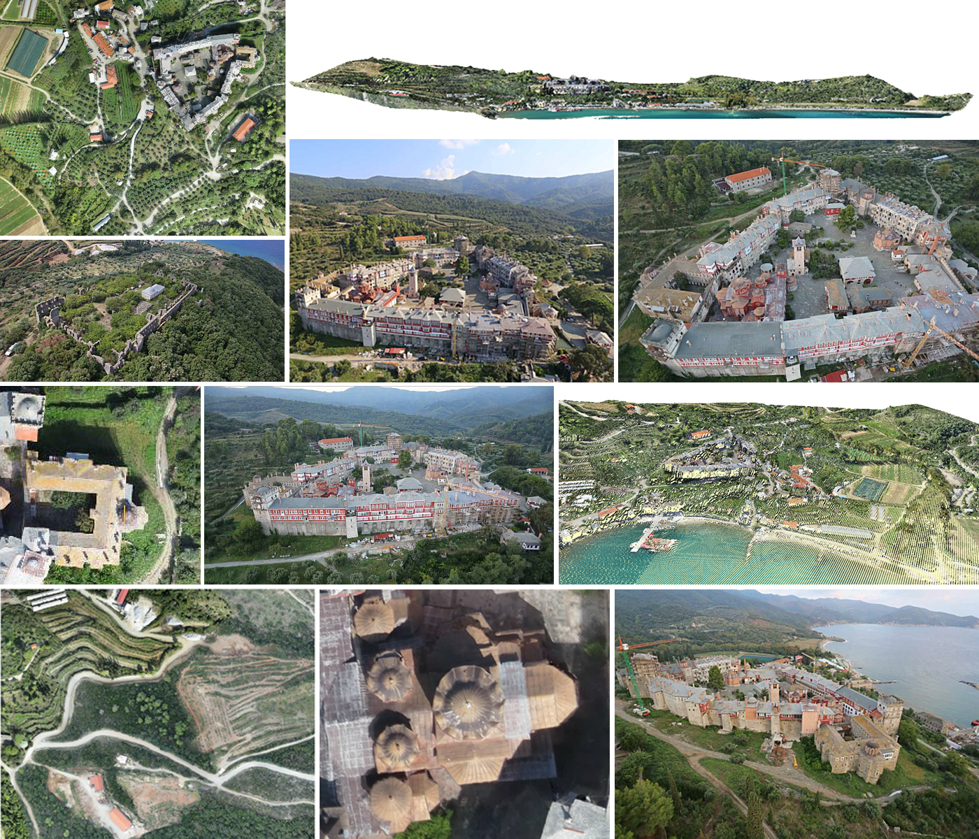
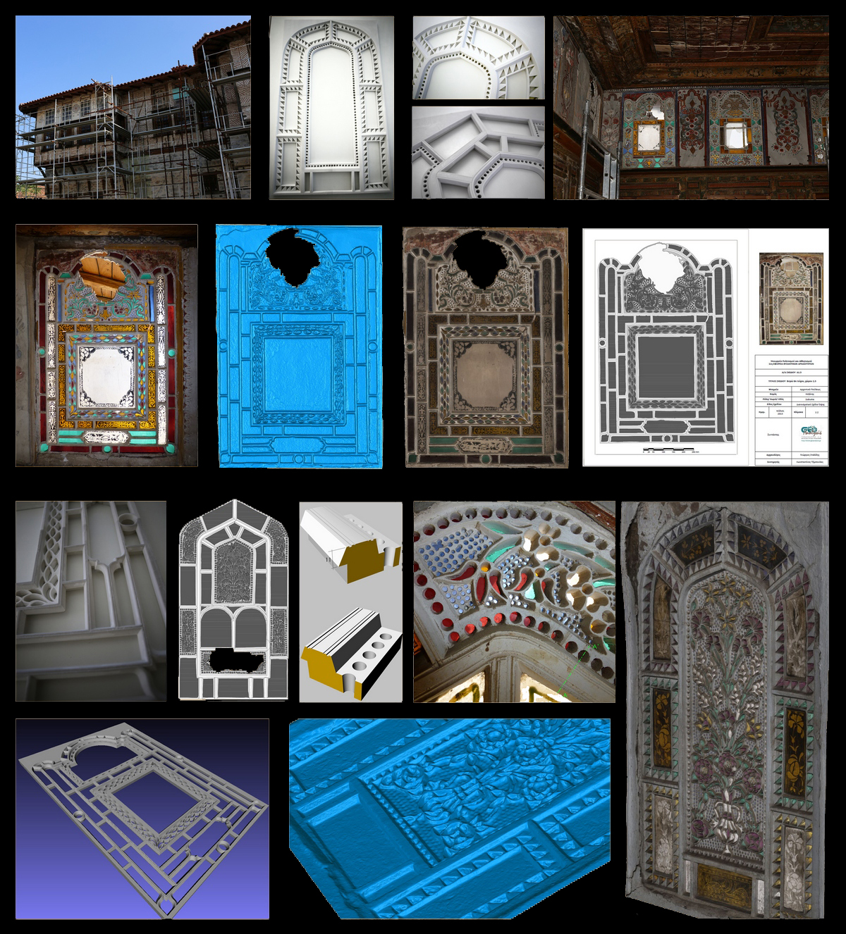
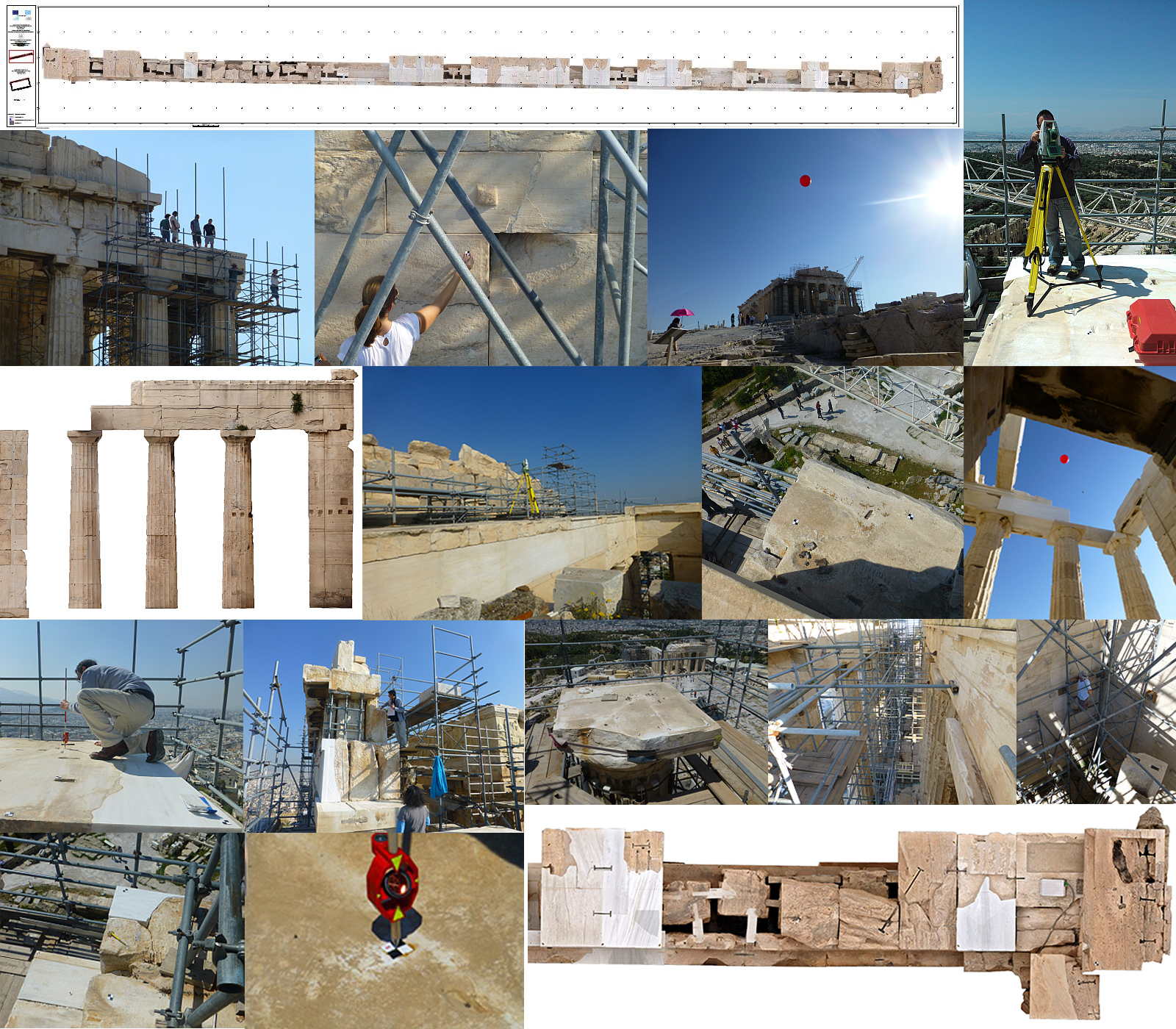
Close range applications in monuments and archaeological sites:
